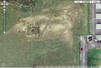
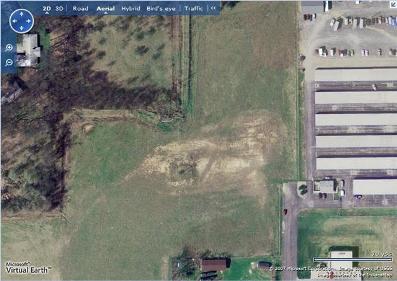
But I like crisp updated imagery more than any company. I like maps that layer information for me and in which navigation is a joy. Unfortunately no online map does everything I need, but one map currently has better and more updated imagery for the South Bend Area than the rest – scan the images below and I bet you’ll agree with me.
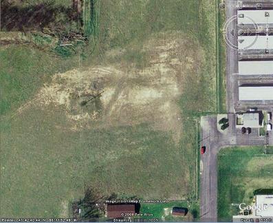
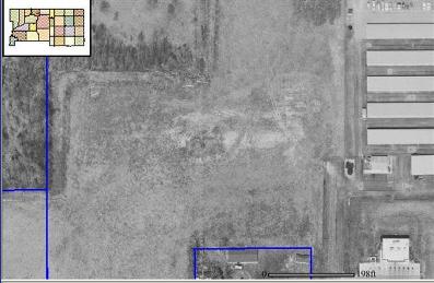
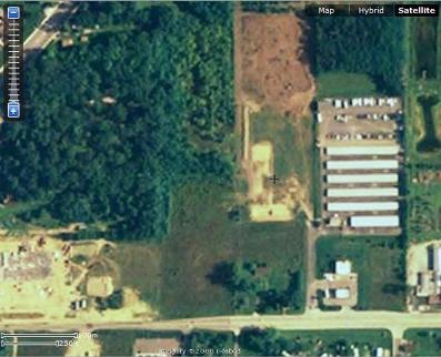
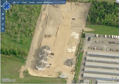
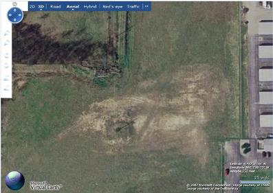
These images are screen captures from the major online mapping programs. They are of the same location, now the site of North Douglas Condos completed building #1 and clubhouse. Most seem to use the same imagery, but one far surpasses the rest.
Though I use Google Maps for directions and everyday mapping, and macoggis for parcel searches, I’m now going to use Microsoft’s Bird’s Eye View for the most current satellite imagery of the area.
Google Maps:
Google Earth:
maccogis GIS:
Yahoo Maps:
Microsoft Live 2D map:
Microsoft Live 2D Bird’s Eye View:
Microsoft Live 3D:
![]()
![]()
![]()
![]()
![]()
![]()
Seems to me that you can’t neccesarily make the assumption that the rest of the mapping sites are inferior to Microsoft’s Bird’s Eye View based upon that single example (though you may have done further research and not reported it). The currency of it could be due to the fact that the 3rd party that they buy their aerial photography from just finished a planned run, whereas some of the other providers may be more up to date in a few weeks/month, when their 3rd parties have completed their runs.
You’re right, the maps are constantly in flux and this could change at any time. However, over the last month, I’ve consistently found the most up to date images for St. Joe County on Microsoft Bird’s Eye views, and I use the maps frequently. I hope they are bested soon because I’m rather partial to Google Earth.